

The page below focuses on our itinerary for our June 2026 trip. For more details about our Lassen Trips, see this page.
Remember to register on eventbrite. (you need to register on eventbrite to confirm you attendance; the Meetup RSVP is just a place to show your interest).
Our main trip includes three days of hiking in Lassen Volcanic National Park. For those who can join us, we have an additional day exploring caves in Lava Beds National Monument.
Fri, June 26: Arriving at camp
Passes are needed to enter Lassen Volcanic National Park; if you don’t have an annual or senior pass, the cost is $30/vehicle and can be paid at the ranger station on the way in (or online in advance). The entrance station does not accept cash, so be ready with your credit/debit card/phone.
Our base camp is Lost Creek Group Campground, site #7.
I recommend taking I5 to Highway 44 and entering the park from the north side; if you enter from Highway 36 on the south side you have significant slow, curvy roads to get to the camp…and we’ll drive on much of it during our adventures.
Those who are staying in hotels/B&Bs along Highway 44 are welcome to join us at camp (not sure if campfires will be allowed, it always depends on the level of fire danger).
Sat, June 27: Two local hikes
The weather forecast for Saturday includes some chance of rain, so we’re staying close to the campground and doing shorter hikes in case one of them gets rained out.
Manzanita Lake loop, 2 miles, no real elevation gain.
We’ll start with a leisurely hike around Manzanita Lake, and a stop at the museum/visitors’ center.
On a clear day, this short and easy loop hike around sparkling Manzanita Lake is the perfect introduction to Lassen Volcanic National Park, showcasing some of the best features of the park – including the glacier strewn Lassen Peak and the young Chaos Crags massif. In fact, it was an enormous rockfall collapse of Chaos Crags which cut off a local creek and created this lake.
Crags Lake, 4.1 miles, 1,000 feet elevation gain
When the cliffs of Chaos Crags sheared off and tumbled down into the valley they also blocked a local creek, creating what is known today as Manzanita Lake.
The hiking trail winds its way through a surviving section of thick evergreen forest running parallel to the jumbles, slowly ascending and eventually thinning out as you climb towards the timberline.
Sun, June 28: Road trip to Devil’s Kitchen
- Pack a lunch; it’s road trip day!
- We’ll experience Lassen’s second largest hydrothermal via a lovely hike through Warner Valley meadows and forest. 4.8 mile, 538 ft hike to Devil’s Kitchen. Since this is a meadow, gnats and mosquitos may be present (I’m working on a research-based analysis of DEET, picaridin, and Oil of lemon eucalyptus / PMD insect repellents…I hope to post it soon).
- Getting to the trailhead is about a two-hour drive, but along the way we’ll have several stops to examine roadside geology.
Mon, June 29: Hike to the summit!
- After a few days acclimating to the altitude, we’ll take on the summit hike.
- This is a tough, but exhilarating, hike up the side of the mountain. AllTrails rates it as five miles and 2,000 feet of elevation gain. A bit of the early portion of the hike is through thin forest, but then the rest is mostly switchbacks along rocky trails. Trekking/hiking poles are recommended. The hike is not ‘technical’ in any way, but it is challenging.
- We’ll start early to avoid the heat of the day. Sunscreen and a good hat are recommended.
- For anyone who is not up for this rigorous hike, we can recommend some other, less strenuous, hikes in the area.
Tues, June 30: Pack up camp; short hike to Burney Falls. Optional: Drive to Lava Beds
- After an early breakfast, we’ll all drive to McArthur-Burney Falls (about one hour drive) for a short hike to the falls. Our planned hike is 2.7 miles, but if anyone wants to just hike to the falls and back, they can return once we reach the falls with a total distance of about 1.8 miles.
- This drive and hike will likely add 3-4 hours beyond driving home, so it’s fine for people to skip it if they need to get back home on Tuesday.
- McArthur-Burney Falls has become so popular that the state recently started required reservations on weekends, but since we’re coming on a Tuesday no reservations are needed…but it may be crowded.
- Those who are joining us for Lava Beds will drive to the campground (about two hours); others can return home.
- Set up camp at Indian Wells Campground.
Wed, July 1: Explore caves in Lava Beds
- 9:00 check in at the Visitors Center to get passes for the caves.
- Depending on the group members’ desires, we’ll explore two or three caves.
- Caves are rated as Beginner, Intermediate, and Expert. We’ll explore one or two Beginner caves, as well as one or two Intermediate caves.
- If you have headlamps, helmets, or kneepads, bring them unless you have used them in other caves (these can carry fungus causing white-nose syndrome on the bats that reside in the caves).
- The Parks website stresses to bring ‘real’ flashlights and not depend on your cell phone flashlight. They have helmets available for purchase for a reasonable price (and they have the logo on them!).
Thurs, July 2: Drive home before the 4th of July traffic gets bad
- We’ll pack up camp, say our goodbyes, and head home.
- Driving back to the Bay Area is 6-8 hours, depending on traffic, your driving speed, your chosen route, and your rest stops.
OK, you caught me
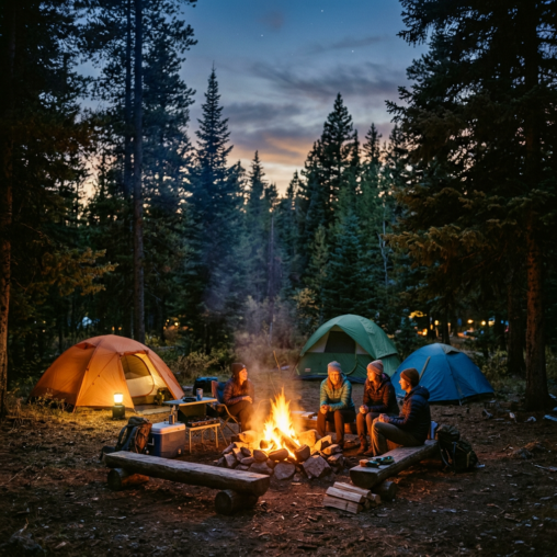
Yes, the image at the top was created by AI. I usually prefer to add real photos from our trips, but I didn’t have one of our campsite, and this was the first one that popped up and it does a good job of capturing the feel of Lost Creek Group Campground.
Questions
Feel free to add questions in the comments section below.
You can also text me in the five one oh area code; my cell number starts with 495 and ends with 7035 (try to scrape that, you spam bots 😊)
Discover more from NorCal Geology & Natural Sciences Hiking
Subscribe to get the latest posts sent to your email.
Hi Lee, Thank you for organizing. I’m so excited! I have hiked to Paradise Meadows a few times and it is gorgeous with a lot of water falls along the way. I’ve also gone to Cliff Lake and Kings Creek Falls. I also really enjoyed Ridge Lakes and it was a tough hike almost straight up. Whew! All of these are fantastic hikes.
Diane, thanks for the suggestions. With the chance of rain, we’ve decided on a couple of hikes near Manzanita Lake and the visitors’ center. See you soon!